CT Definition of Brownfields: "Sites, once used for industrial, manufacturing, or commercial uses, have been abandoned or underutilized due to known or suspected contamination from past uses. Unknown environmental liabilities have been preventing communities, developers and investors from restoring these properties to productive use and revitalizing impacted neighborhoods."
The Office of Brownfield Remediation and Development (OBRD) under the CT Department of Economic and Community Development provides financial and technical assistance. This page includes information on a variety of funding and liability relief programs offered by the state.
State Funding Program: the state regularly announces grant and loan brownfield programs. Open solicitations and a tentative schedule for future solicitations are found on the OBRD main page. For more details, refer to this CT Funding Fact Sheet.
Liability Relief Program: Connecticut has several liability relief programs covering both municipalities and private owners and prospective purchasers; an overview is available in the Fact Sheet and further information on the DECD website.
The CT Department of Energy and Environmental Protection (DEEP) also provides technical support and resources for brownfield redevelopment.


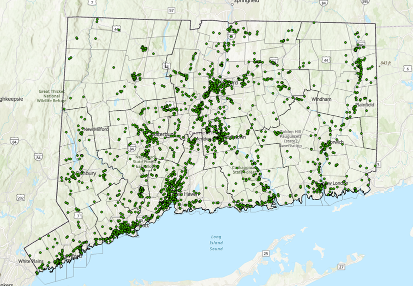
Brownfield Inventory
CT DEEP maintains a brownfields inventory that includes sites that have entered federal or state programs.
 The CDC National Environmental Public Health Tracking Network includes a map in the Data Explorer Tool by census tract for two cancer indicators: crude prevalence of cancer among adults and number of breast cancer cases for a 10-year period. These are NOT actual cancer rates; they are modeled on the basis of survey responses and the PLACES project (Population Level Analysis and Community Estimates).
The United States Data Statistics website includes data visualizations with actual cancer rates, which are available at the county and congressional district level.
The DPH Interactive Map of CT Tumor Registry provides data for different types of cancer by town for two time periods: 1998-2002 and 2010-2014.
 The Asthma surveillance maps includes data by Census Tract (Emergency Department visits, Hospitalization rates); an interactive map is also available on the Asthma Explorer
 The only dataset available nationally for birth defects is through The CDC National Environmental Public Health Tracking Network and it provides data at the county level for 12 different types of birth defects.