
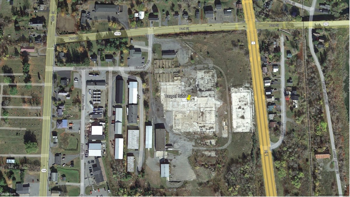
 Satellite Imagery of Current Site Conditions. Source: Google Earth.
Traffic, Site Access & Parking Considerations
Traffic, Site Access & Parking Considerations
- State regulations do not allow for direct connection to Rt. 1 (bordering the Site to the east). This limits site access options and subsequently, reuse options.
- Two-way traffic with pedestrian safety considerations and appropriate signage: Crosswalks and stop signs.
- Proposed site access options:
- Public access road: Fort St.
- Private municipal road (for municipal on-site services): Birdseye Ave
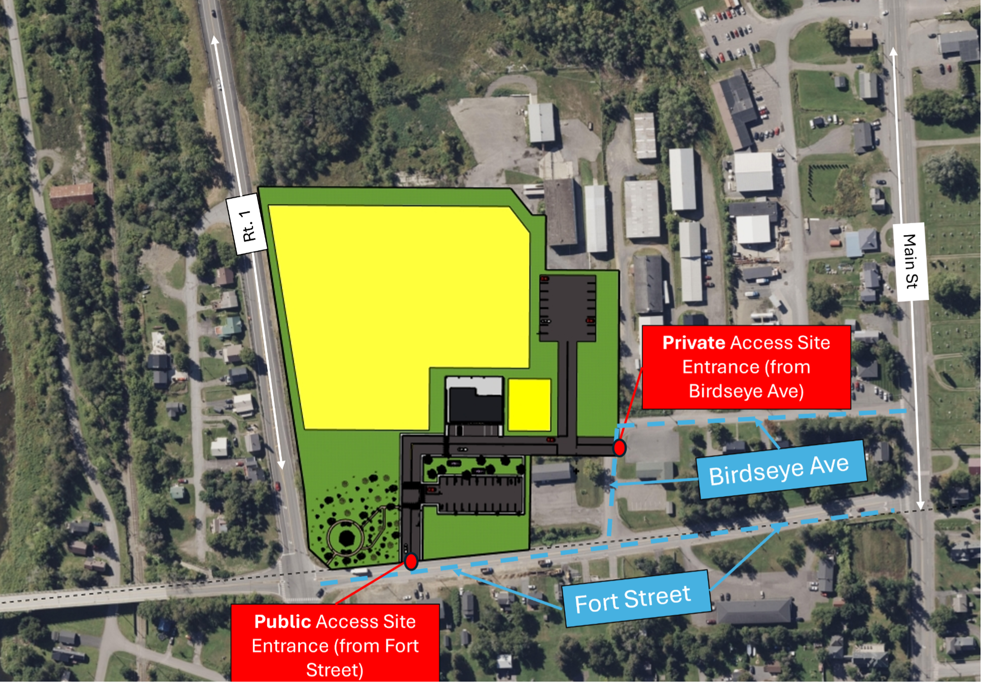
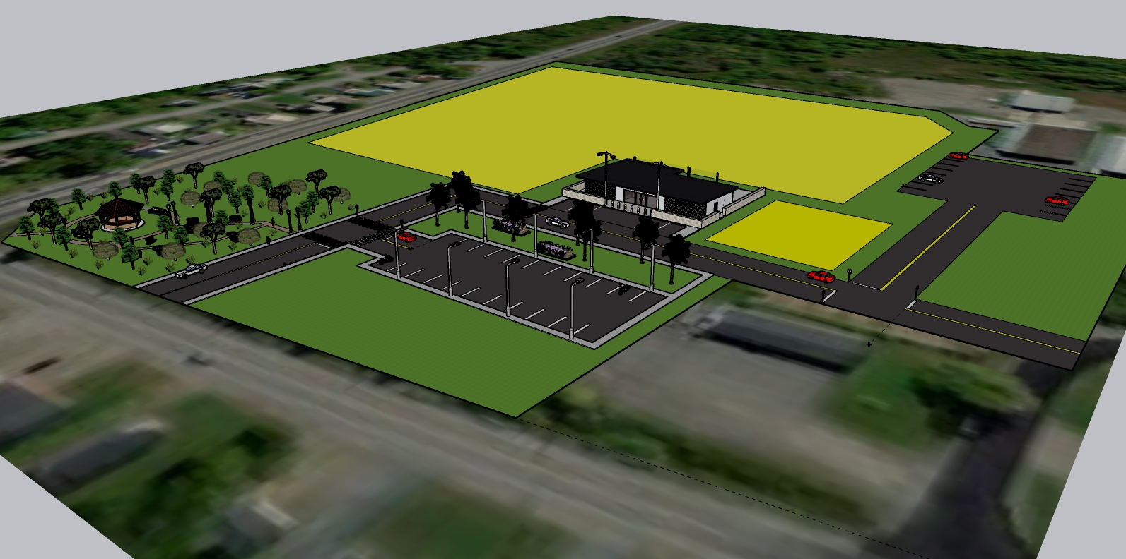
Police Station

Mixed-Use and Parking

Green Space

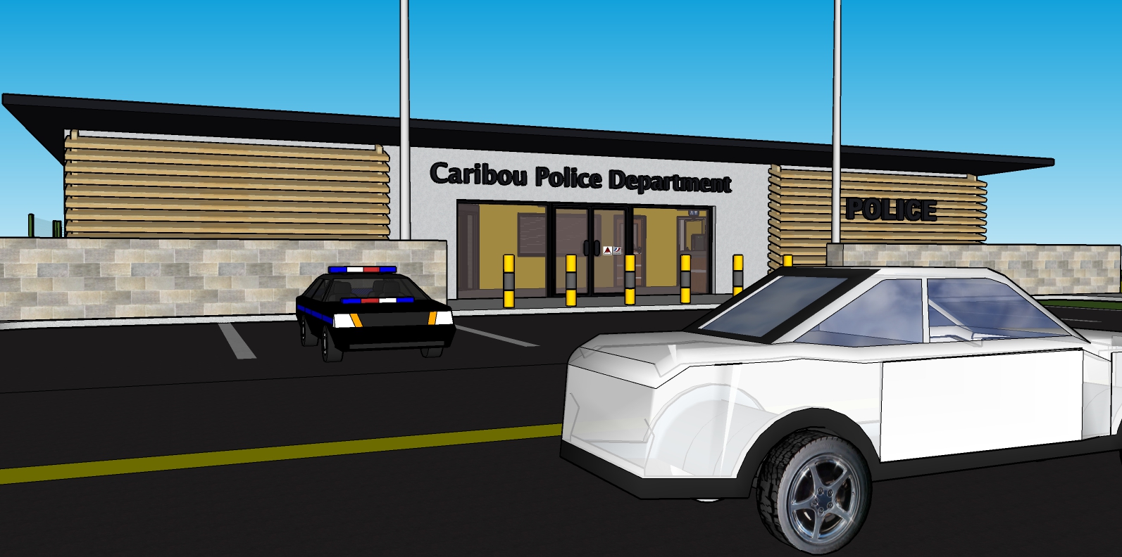
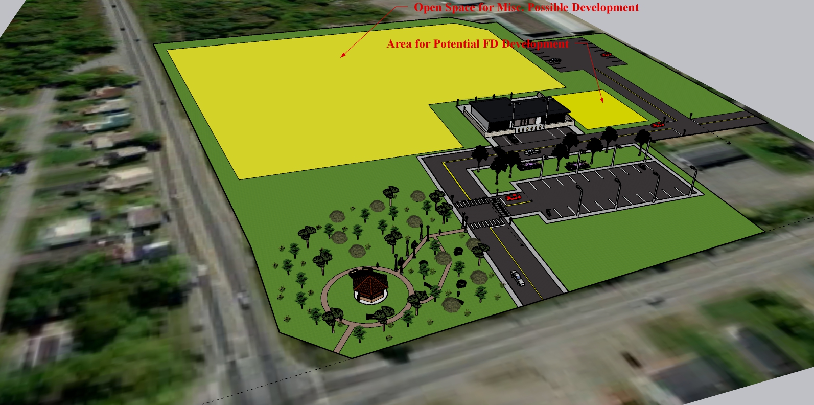

Police Station


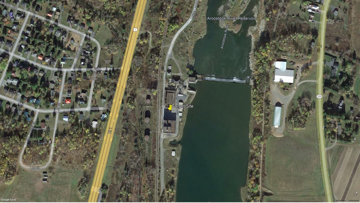 Satellite Imagery of Current Site Conditions. Source: Google Earth.
Floodplains/Wetlands
Floodplains/Wetlands
- The proximity to the Aroostook River makes the Diesel plant site at risk for flooding. The site is directly abutting the river. See satellite imagery below.
- According to the Maine Flood Factor Report, the eastern portion of the site along the river is within the 100 year storm floodplain of the Aroostook river.
- To the south of the site, there is a freshwater forested/shrub wetland and freshwater emergent wetland. These wetlands do not fall within parcel 5059, but they should still be noted during the demolition and construction process. See Wetlands map below.
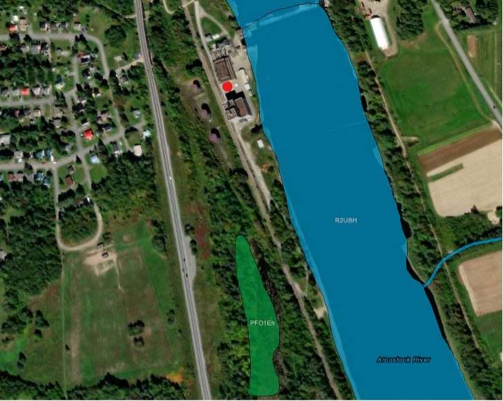
Wetlands Map. Source: USDA Wetlands Mapper
[Target Site Marked w/ Red Dot; Nearby Wetland Shaded Green]
Traffic, Site Access & Parking Considerations
Traffic, Site Access & Parking Considerations
- The site can be accessed via Lower Lyndon St, which connects to Fort St just off of Route 1 (see “Figure x. Birds’ Eye View with Points of Access Labeled”
- Lower Lyndon St is wide enough to support two-lane traffic
- The site can also be accessed on foot by a path connecting to Crosby Ave. This path goes under Route 1 and connects the space to a neighborhood.
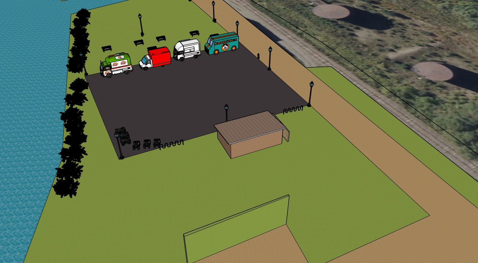
- The parking lot that will be added in the redevelopment plan will support 40 cars including two handicap spaces, and four food trucks. The aisles between each row of cars will be about 24 feet wide to support two-way traffic.
Steam & Deisel Site Reuse Plan
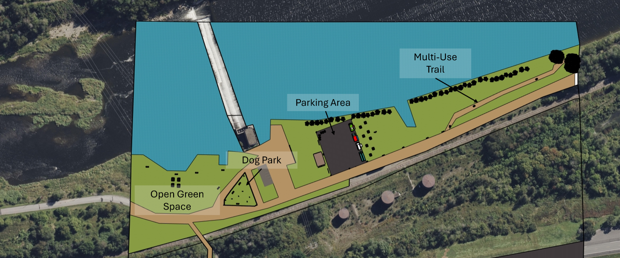
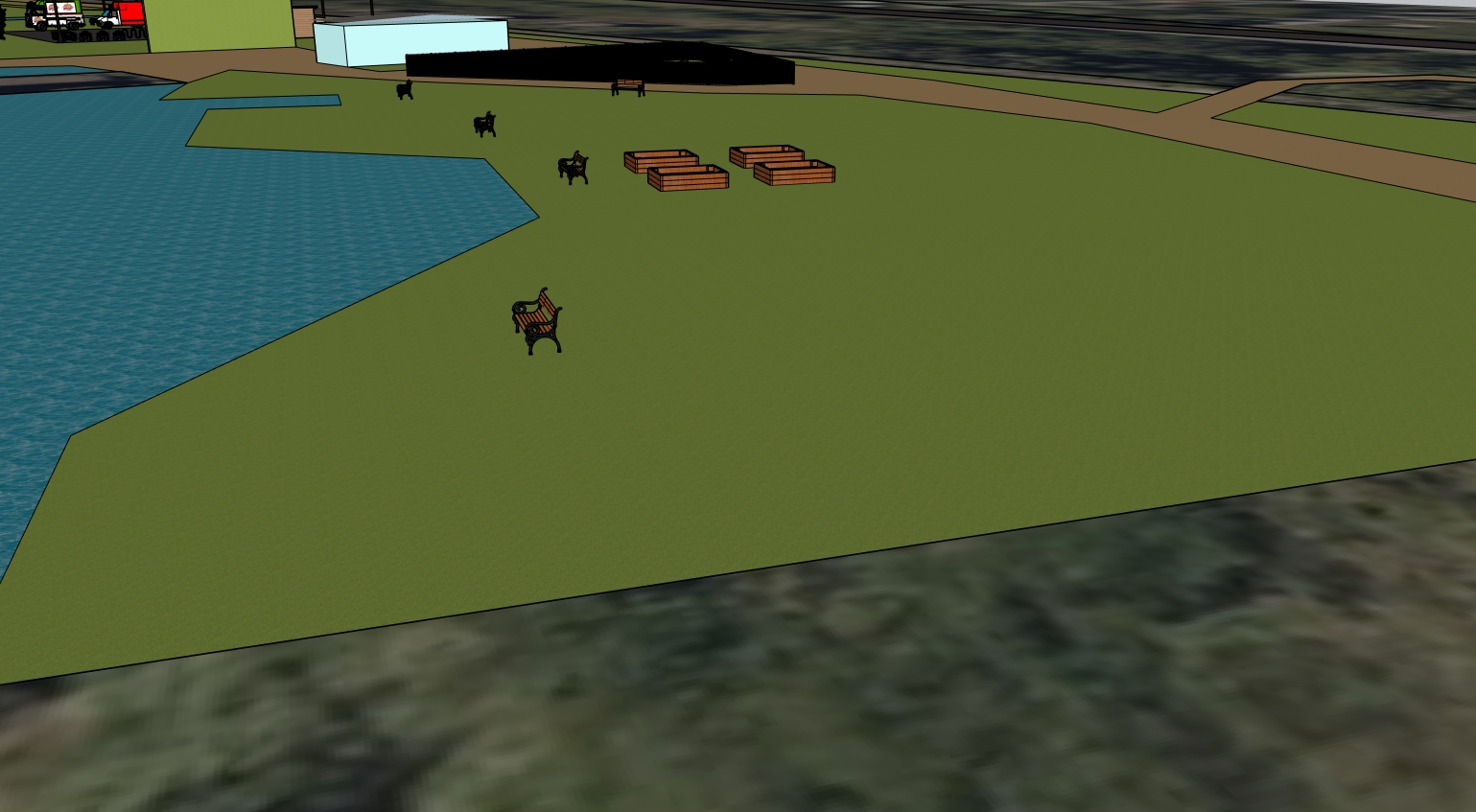

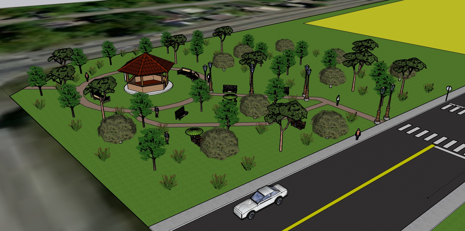
Open Green Space


