Who is NERHA?
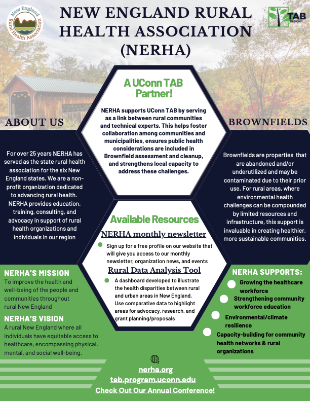
The New England Rural Health Association (NERHA), previously known as the New England Rural Health Roundtable, was established in 1997, with funding from the National Rural Health Association (NRHA). NERHA is committed to improving the health and well-being of rural communities throughout the six New England states of Connecticut, Massachusetts, Maine, New Hampshire, Rhode Island, and Vermont.
What does NERHA do?
NERHA is unique as the only regional rural health association in the country, enabling the sharing of learning and best practices across all six states. NERHA has a wide variety of members across all sectors of healthcare professions, stakeholders, and the community, including Rural Health Clinics, Critical Access Hospitals, community health centers, behavioral health and substance use, oral health/dental, social services, community-based organizations, academic institutions, and individuals who are passionate about rural health.
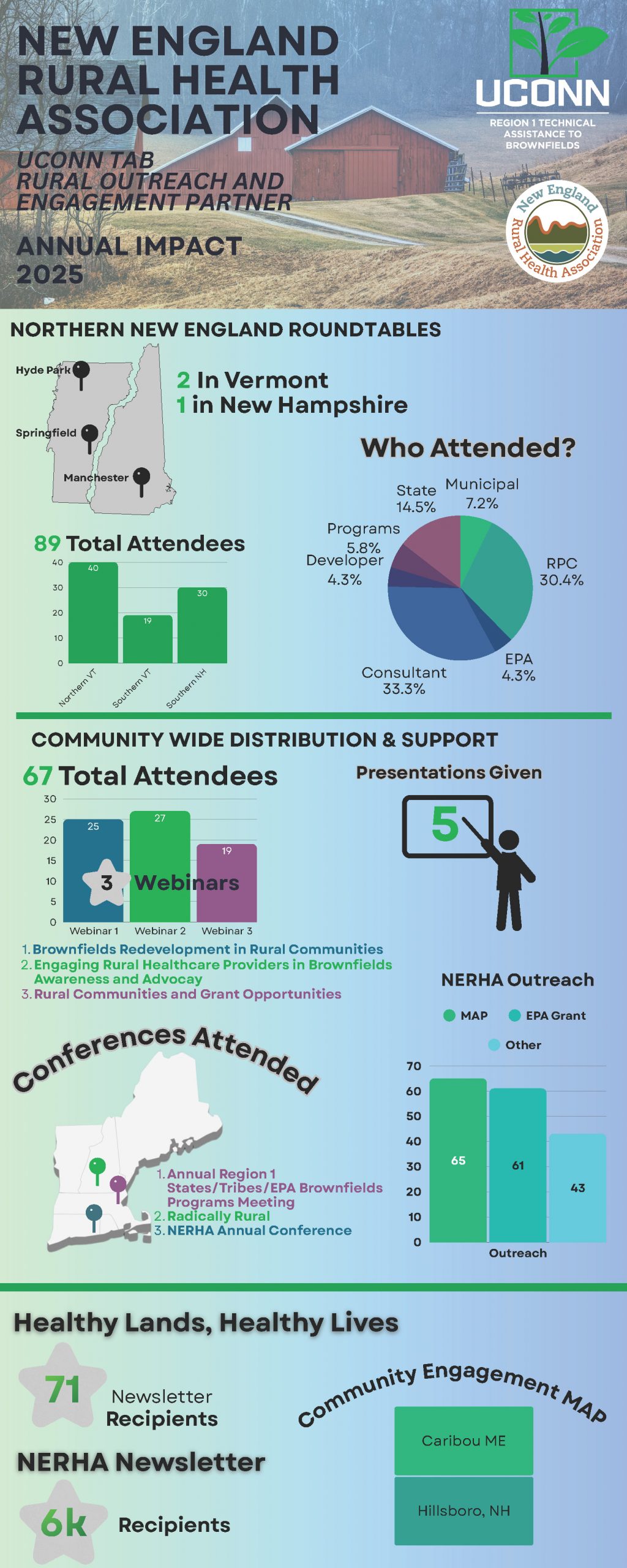
NERHA works with rural communities across New England to support healthy redevelopment, community-driven planning, and environmental health education related to brownfields and contaminated sites.
More Details:
Rural Definitions
There are several definitions for the term "rural". Generally, it refers to places that are outside of cities (urban) and large suburban areas. US Census Bureau, USDA, and Health Resources and Services Administration offer 3 different definitions for identifying a community as "rural". Each of these definitions utilizes population, population density, and access to resources as indicators of rurality.
By Population Size
- Defined by how many people live there
- Small towns or communities with low population
- Depends on definition: Often fewer than 2,500–50,000 people
By Population Density
-
Measure of population per square mile
-
Rural Areas have smaller population densities
-
More open land, farms, forests, or natural areas

By Distance From Urban Centers & Resources
- Defined by how far a place is from a city or metropolitan area
-
Limited access to major hospitals, universities, or large job centers
-
Homes, businesses, and services are physically farther apart
-
Longer travel times for basic services
Federal government definitions (U.S.) also vary by federal agencies.


U.S. Census Bureau
- Defines rural areas as all population, housing, and territory that are not classified as urban.
- Urban = Densely developed area with 5,000+ people OR 2,000+ housing units.
- Rural areas include: Small towns and villages, agricultural and farming communities, forested, coastal, mountain, and remote regions, areas with lower population density located outside urban boundaries.
- Because the Census Bureau defines rural as "everything that is not urban," rural communities can vary significantly in size, geography, demographics, and access to services.
- Rural = All population, housing, and land outside Urban Areas
USDA (U.S. Department of Agriculture)
- Uses several definitions of rural depending on the program or purpose, often considering
factors such as population size, proximity to metropolitan areas, and commuting patterns. - Under many USDA Rural Development programs, rural areas are generally defined as communities with populations of fewer than 50,000 residents, though eligibility requirements vary by program.
-
The USDA's rural classification systems include:
-
Rural-Urban Continuum Codes (RUCC): Classifies counties based on population size and their relationship to metropolitan areas.
-
Urban Influence Codes (UIC): Measures the influence of nearby urban centers on rural counties.
-
Rural-Urban Commuting Area (RUCA) Codes: Uses population density, urbanization, and commuting patterns to identify rural communities.
-
Health Resources and Services Administration (HRSA)
- Uses a definition of rural that focuses on healthcare access, workforce availability, and service
delivery needs, considering factors such as geographic isolation, commuting patterns, and access to healthcare services.
- Rural communities are often characterized by limited access to healthcare services and shortages of healthcare providers.
- Common HRSA rural classification methods include:
-
-
Rural-Urban Commuting Area (RUCA) Codes
-
Federal Office of Rural Health Policy (FORHP) rural designations
-
Geographic areas identified as having healthcare workforce shortages or limited access to care
-
Rural Datasets
Use the resources below when applying for Brownfields funding to demonstrate your community's need and rural challenges. For more information, visit the webinar: Rural Communities and Grant Opportunities
Rural Data Explorer RHI Hub: This resource provides county-level annual data on key indicators, including demographics, poverty, healthcare access, workforce shortages, and other socioeconomic and health measures. It offers a concise, searchable way to explore and compare rural and national data to better understand community conditions, health access, and population-level trends.
State Fact Sheets USDA: The USDA ERS State Fact Sheets provide state-level data on population, demographics, income, poverty, employment, and earnings, along with economic structure and industry breakdowns. They also include agricultural information such as farm numbers and size, farm income, major commodities, and agricultural exports, offering a concise snapshot of each state’s socioeconomic and rural context.
Rural Data Analysis Tool: The NERHA Rural Data Analysis Tool provides an interactive, map-based platform for exploring rural health and demographic conditions across New England. It includes county-level data and visualizations that allow users to compare rural and urban areas using indicators such as population characteristics, socioeconomic conditions, health outcomes, access to care, insurance coverage, and other social determinants of health. The tool is designed to highlight rural–urban disparities and supports exploration of multiple data layers across states and counties, enabling users to better understand geographic differences in health and wellbeing across the region.